GeoPrism Registry Features
Table of contents
- System Management
- Data Set Definitions
- Hierarchy Management
- Change Over Time
- Data Integration
- Integrated Data
- Historical Events
System Management
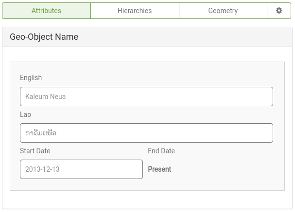
Localization
GeoPrism Registry can be localized to different languages for both application pages and data elements including:
- Geo-Object Types
- Hierarchies
- Geo-Objects (including attributes)
- Lists This makes it possible to navigate the system and record data in multiple languages.
Organization Management
GeoPrism Registry supports the management of lists, spatial data and hierarchies across multiple organizations, so that only those with the responsibility to maintain data for a given organization can do so within that organization only.
User Management
GeoPrism Registry supports management of users within and across organizations.
User Roles Within Organizations:
- Registry Administrator (RA)
- Registry Maintainer (RM)
- Registry Contributor (RC)
User Roles Across Organizations:
- System Administrator (SA)
Email Notifications
GeoPrism Registry uses email settings to send email notifications to users of the system, in particular account creation invitations and automated change request notifications.
Data Set Definitions
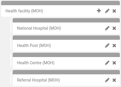
GeoPrism Registry organizes data by Geo-Object Types which are containers for Geo-Objects that are of the same type and share the same data schema. Geo-Object Types are used to define hierarchies, create lists, and generally explore or manage Geo-Object data.
Access and Management
All Geo-Object Types and Geo-Object Type Groups are managed by organizations to ensure Geo-Object curation from authoratative groups. Organizations can set the visibility of Geo-Object Types and Groups to ensure privacy of sensitive data.
Individual Geo-Object Types
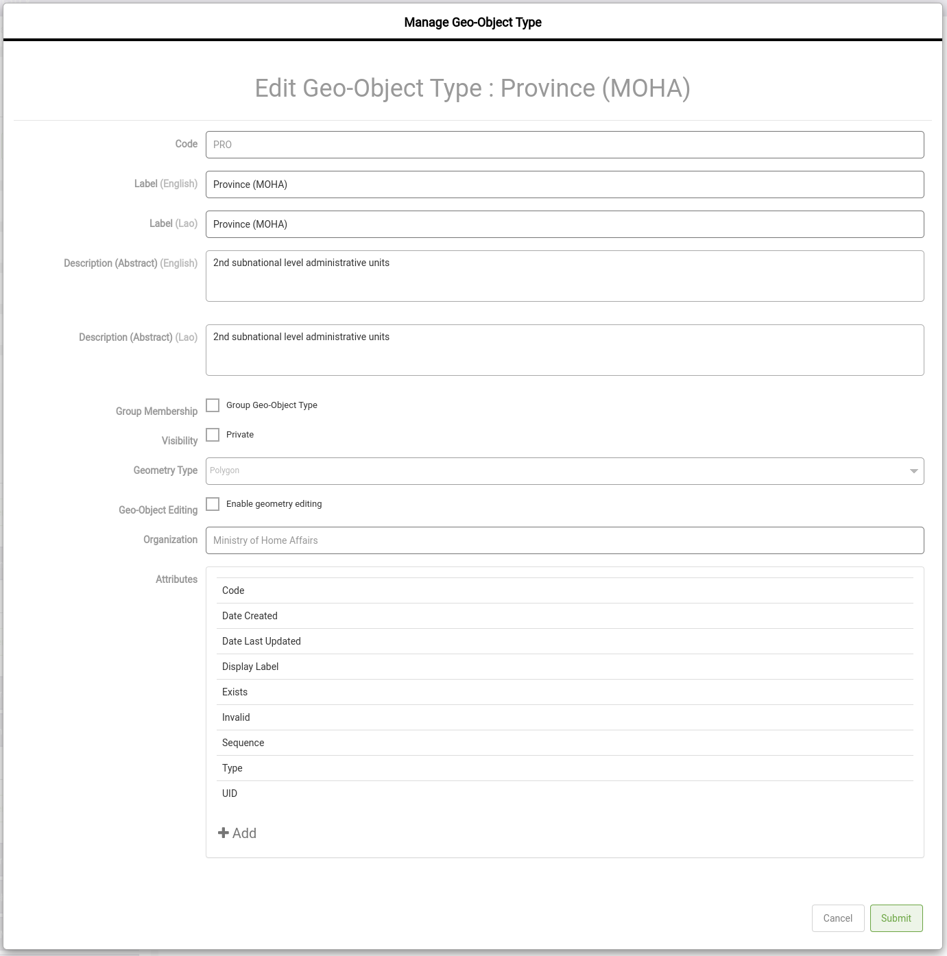
Individual Geo-Object Types contain Geo-Objects of the same type. 
Customization (e.g. custom attributes)
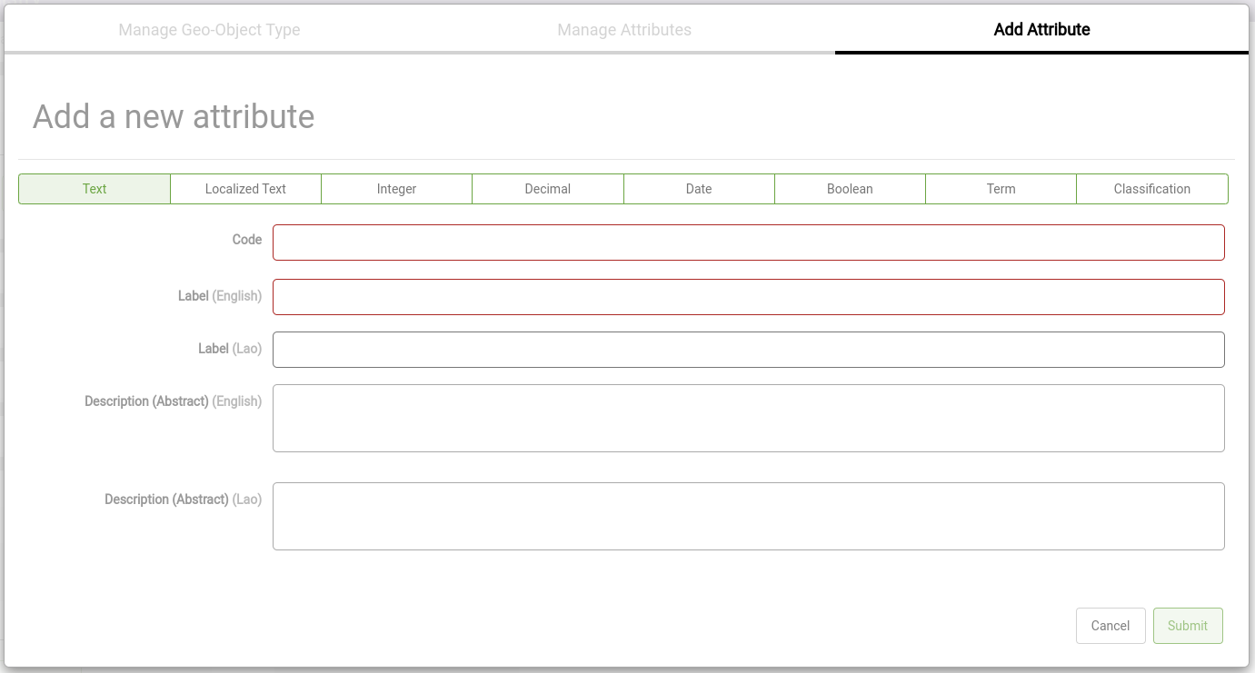
Geo-Object Types have configurable default properties including the ability to add custom attributes beyond the defaults.
Geo-Object Type Groups
Geo-Object Type Groups allow for grouping Geo-Object Types that share common data schemas but represent differnt types of data.
Hierarchy Management
Hierarchies are the formal definitions of how Geo-Object Types relate to each other. They provide a structure for how Geo-Objects can be linked.

Access and Management
All hierarchies are managed by organizations to ensure Geo-Objects can be linked and shared by authoratative groups.
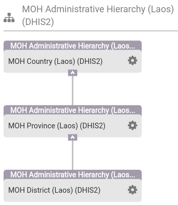
Single Hierarchies
Single hierarchies contain Geo-Object Types from a single organization.
Multiple Hierarchies
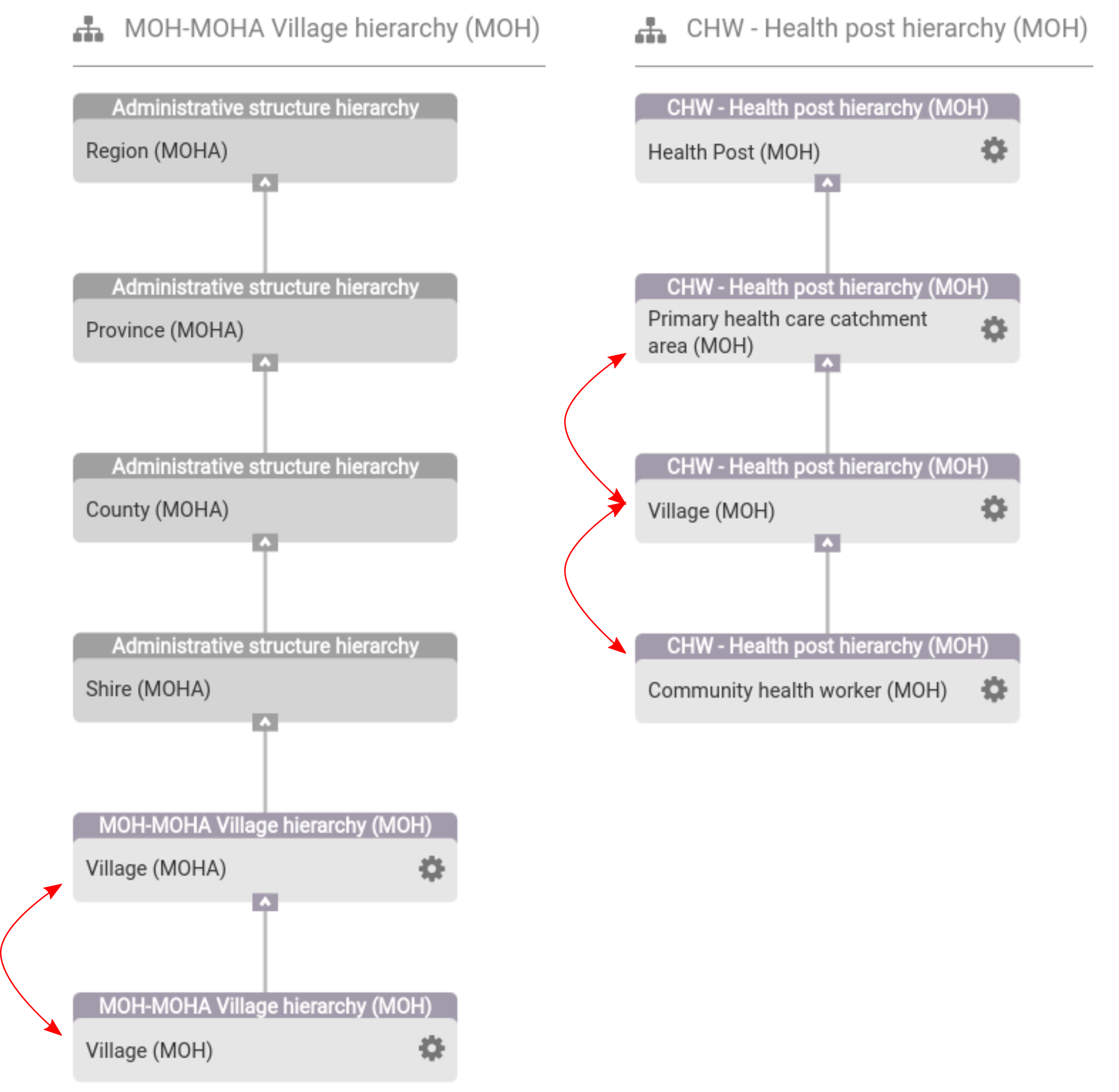
Multi-hierarchies enable the ability to share Geo-Object Types across hierarchies to link data between Geo-Objects to fit different operational needs without duplicating Geo-Objects across hierarchies. Instead only the relationship links are managed in each hierarchy to enable the unque queryability of each hierarchy.
As an example, Village (MOH) plays a different role in the CHW - Health post hierarchy than the MOH-MOHA Village hierarchy.
Inheritance
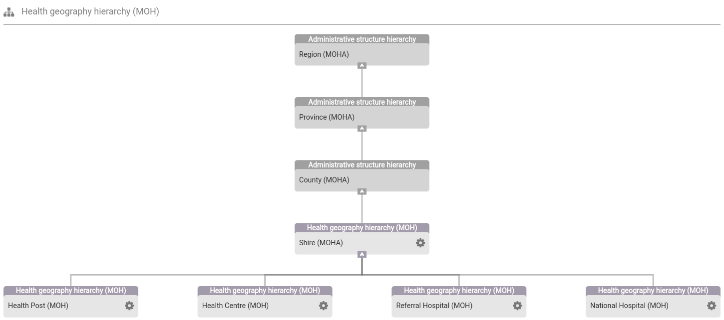
Hierarchies can be shared across organizations using inheritance. This means that Geo-Objects and the linked relationships between them can be managed by an authoritative group while being extended by another hierarchy.
Change Over Time
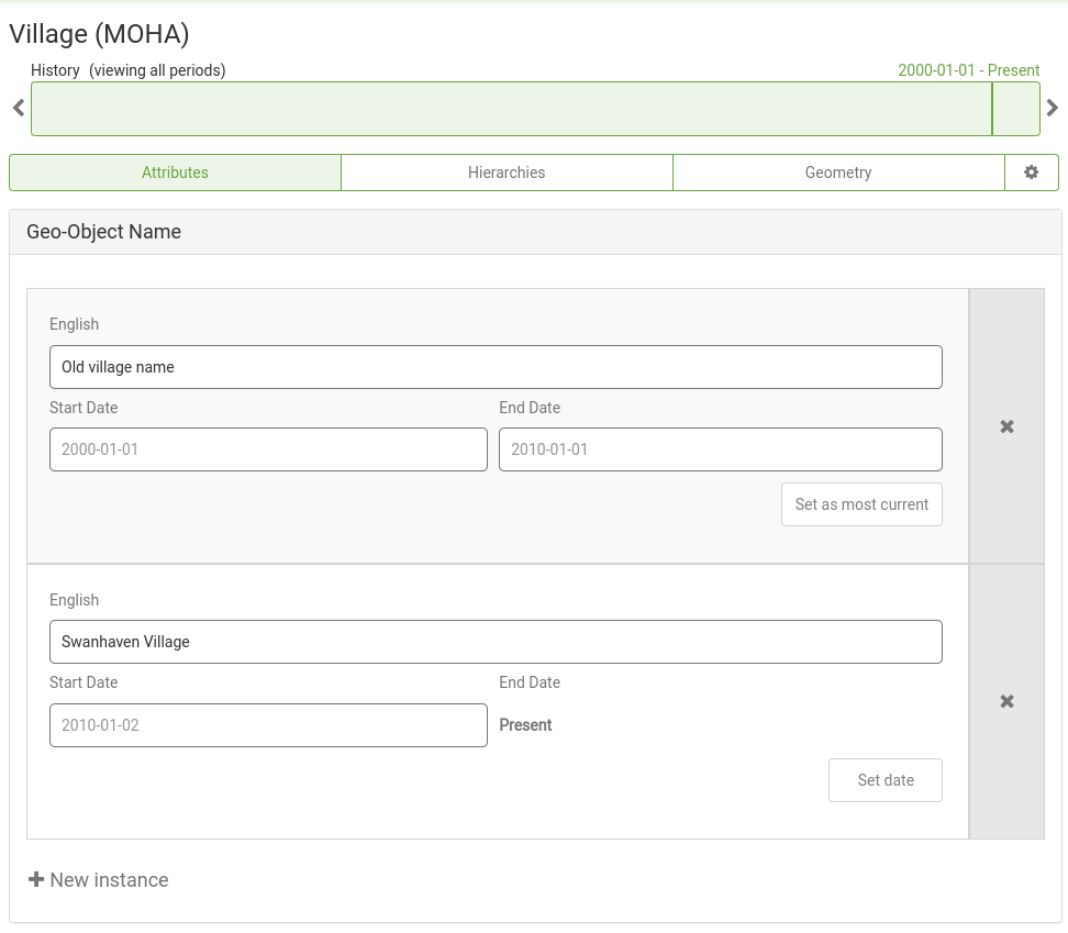
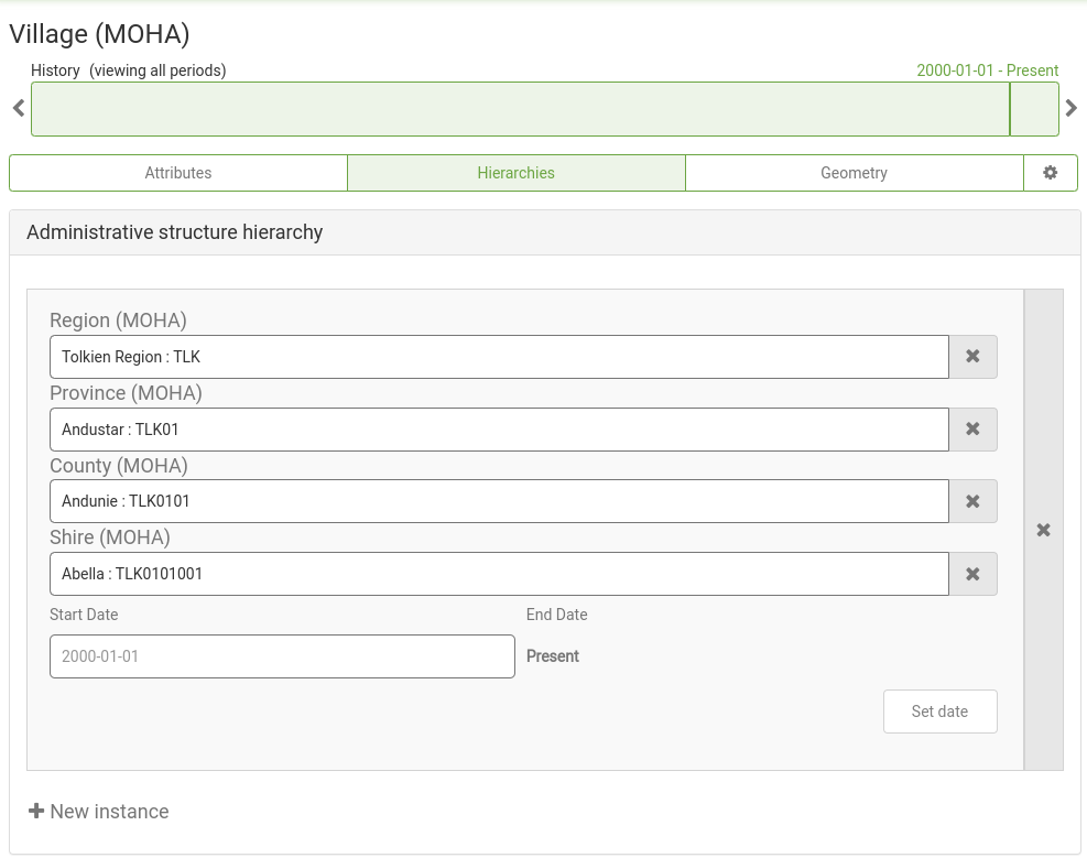
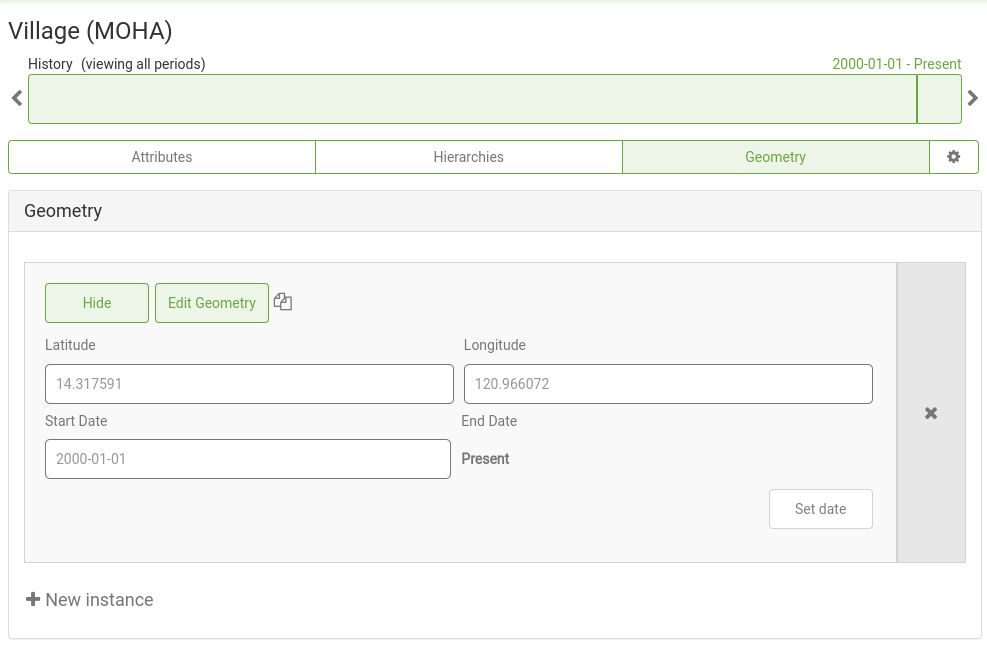
To maintain a single representation of a Geo-Object changes can be tracked through time for attributes, hierarchies the Geo-Object participates in, and geometries.
Data Integration
Data imported to GeoPrism Regsitry is integrated into Geo-Object Types for specific hierarchies as Geo-Objects to maintain a single source of truth. Importing allows for both curating Geo-Objects and the relationships (links) getween Geo-Objects in a hierarchy.
All data imports and updates are validated in multiple ways to maximize data integrity:
Geo-Object Validation
- Attribute type constraints are enforced that only allow values of types that match the type of the column. For instance, an integer or float attribute can only be assigned to a column which only has numeric cells. The types include:
- Text
- Localized Text
- Integer
- Decimal
- Date
- Boolean
- Term
- Classification
- Geo-Objects can only be assigned to Geo-Object Types that are present in the Hierarchy definition.
- Geo-Object updates check if Geo-Objects exist based on either code only or by code, label, or a synonym of a label.
- If an existing Geo-Object match is found on update the time period must be valid.
- Duplicate Geo-Objects are not allowed in the same Geo-Object Type. Uniqueness is determined by the import strategy setting.
Relationship Validation
- Parent matching ensures that matches are only created for Geo-Object Types that are above the target in the hierarchy tree.
- Parent matching validates that the parent exists in the system and is valid for the given time range.
- Checking for existing Geo-Objects can be done by either code only or by code, label, or a synonym of a label.
Spreadsheet Imports
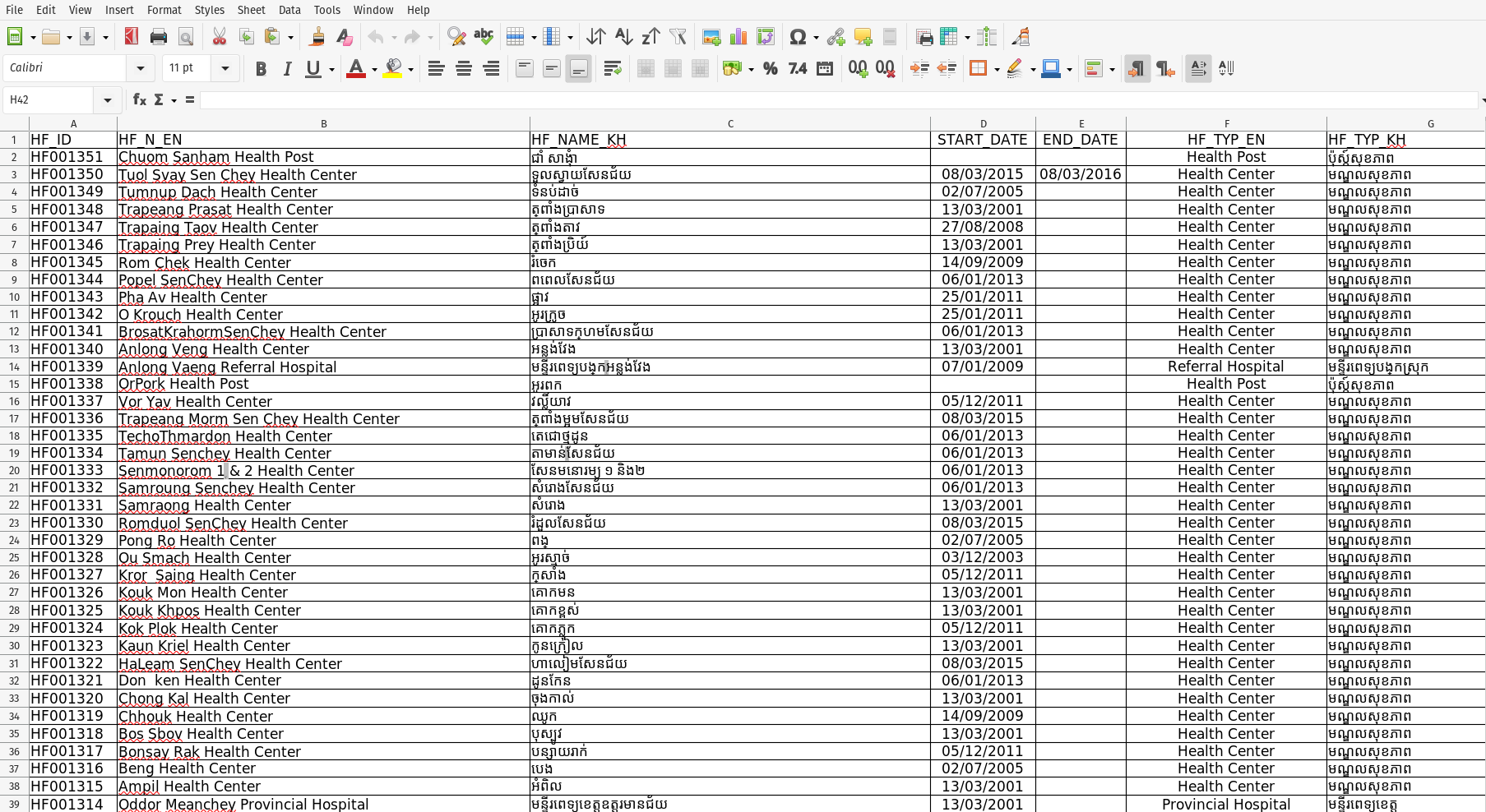
Spreadsheets can be imported that include attribute data, coordinates (for point data), and hierarchies (when recorded in columns representing levels).
Shapefile Imports
Shapefiles can be imported that include attribute data as well as point, line, or polygon geometries.
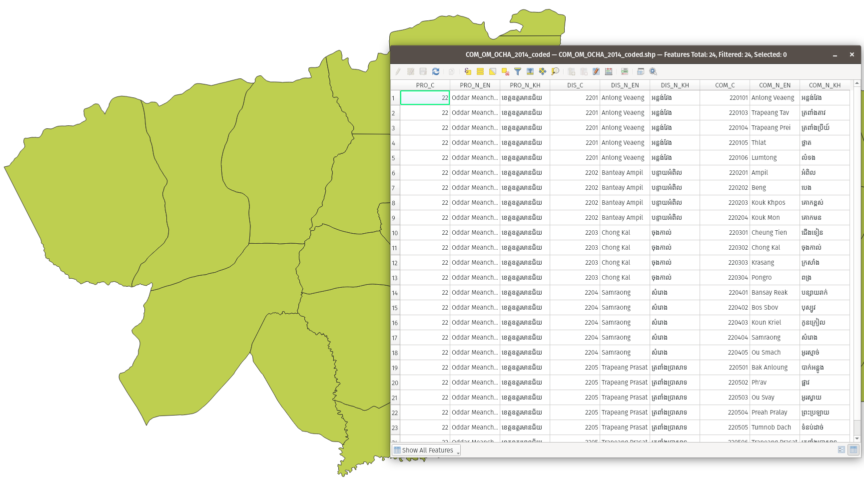
Import Workflow
Imports to GeoPrism Registy are configurable and include quality checks to ensure integrated data maintains a high level of data integrity.
Configure Attribute Matching
Columns in a spreadsheet or shapefile can be mapped to Geo-Object Type atteibutes. 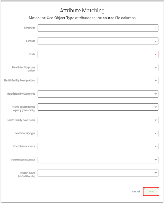
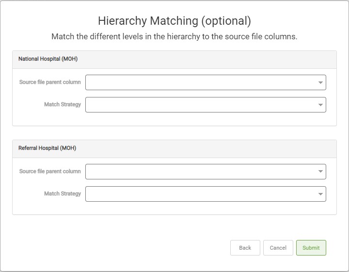
Configure Hierarchy Relationship Column Matching
Columns in a spreasheet or shapefile that represent hierarchy levels can be mapped to Geo-Object Types in the target hierarchy.
External System Registration
GeoPrism Registry supports integrating with external systems to help facilitate the exchange of data between systems.
Supported Integrations
- District Health Information System 2 (DHIS2)
- Reveal
- Fast Healthcare Interoperability Resources® (FHIR)
Integrated Data
Data that’s been integrated into GeoPrism Registry is available through robust tools for veiwing, exploring, updating, and sharing.
Lists
Lists allow for creating tabular views of Geo-Object data for specific hierarchies. Lists are algorithmically generated based on configuration of list types.
Single Date List
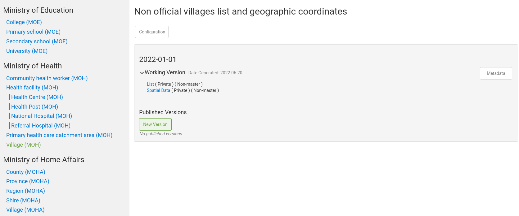
A single date list allows for maintaining versions of a list for a specific date.
Frequency Based List
A frequency based list allows for maintaining versions of lists for every period across a time range (e.g. annual, bi-annual, etc…).
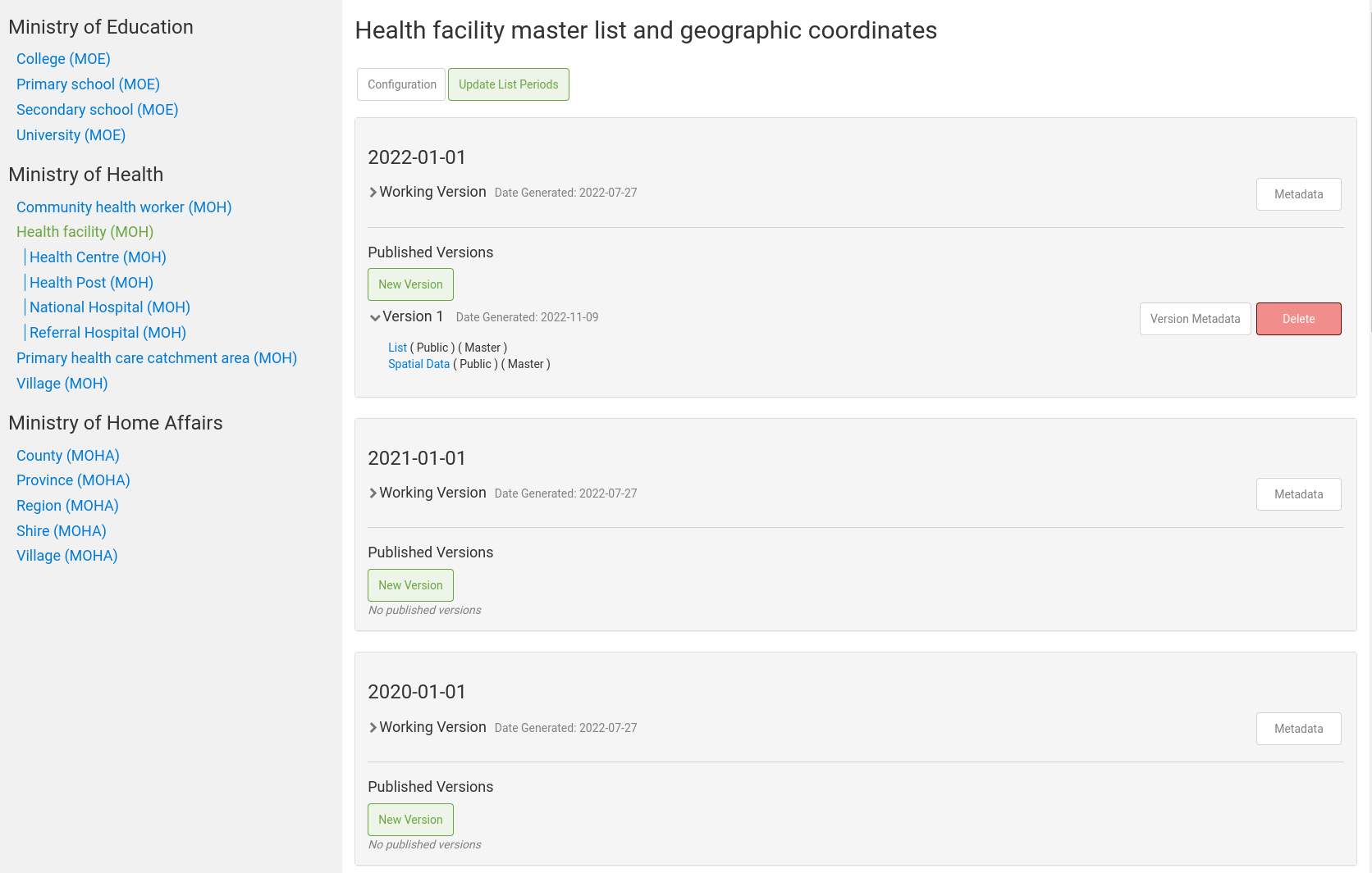
Period Based List
A period based list allows for maintaining versions of lists for specific periods of time.
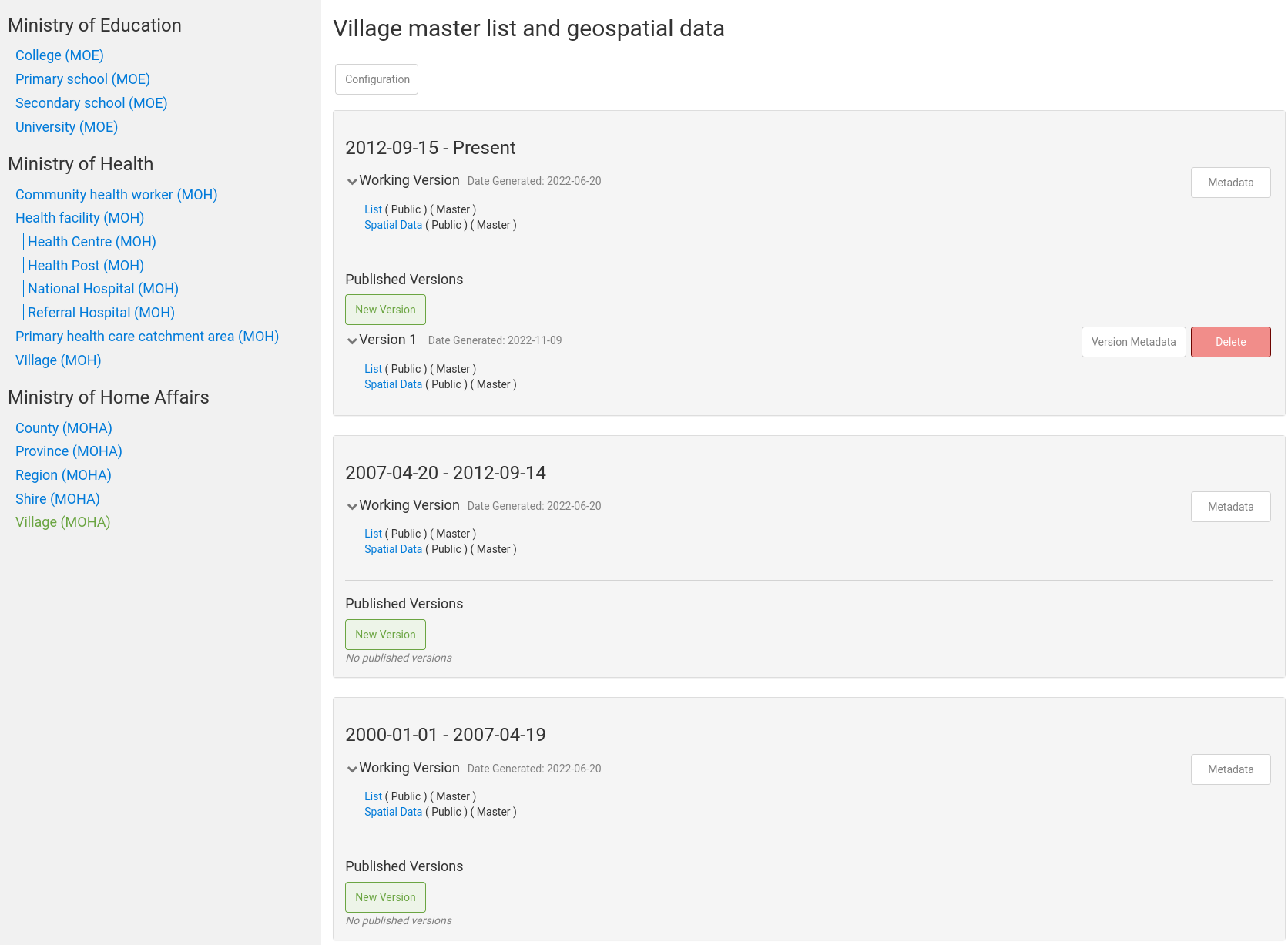
List Period Elements
Each list period has a working version and any additional published historical versions.

List Working Versions
A working version which contains the current version of the data and is the primary place to review or edit Geo-Object data.

Historical versions
Published versions are historical snapshots of lists used to keep historical records of Geo-Object data.

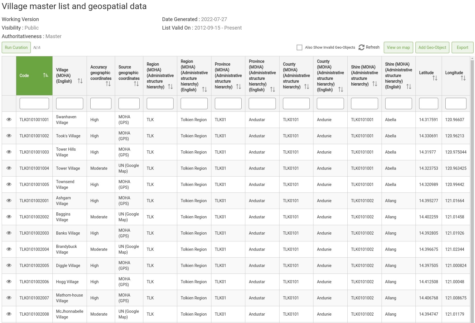
List Contents (tabular)
A list itself, whether a working version or published version, is a tabular view of the Geo-Object data.
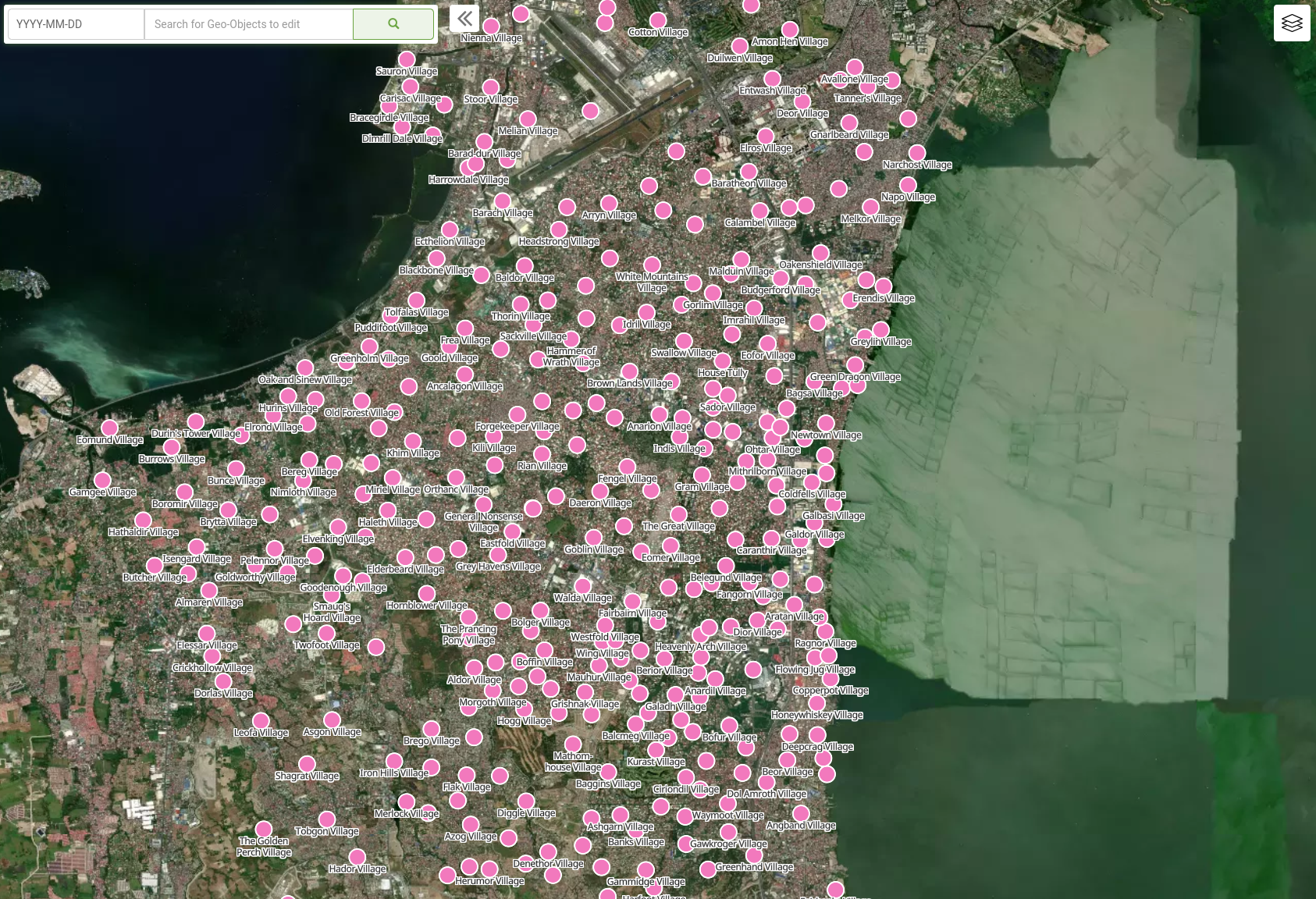
List Geospatial Data
A lists geospatial data, whether a working version or published version, is a map view (viewed in the Esplorer) of any geometries associated with the Geo-Objects in a list.
Explorer
The GeoPrism Registry Explorer allows for finding, viewing, comparing, and editing geospatial data.
View List Data Spatially
Points, lines, and polygons can all be visualized and edited.
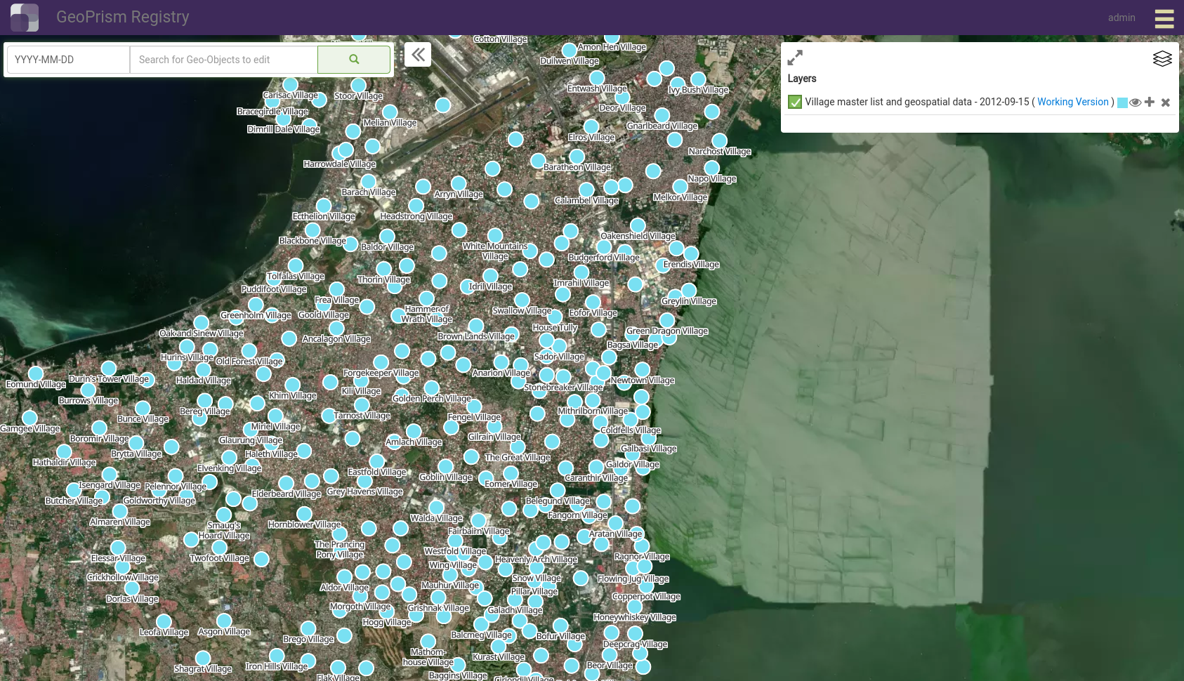
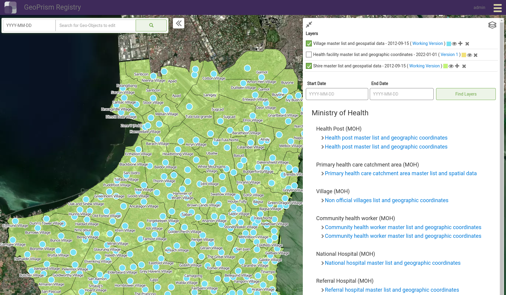
Search For and Viewing Contextual Layers
Context layers are geospatial data from other lists in the system that can be added to the map to build a more complete picture.
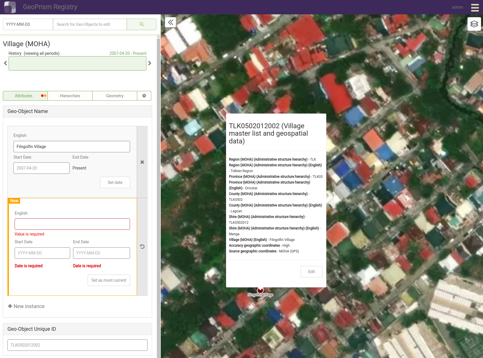
Edit Geo-Objects
Geo-Object attributes, hierarchy relationships, and geometries are editable through the Explorer.
Change requests
Change requests are created when users Registry Contributors submit changes for a Geo-Object to be reviewed by a Registry Maintainer.
Share Data
Lists or geospatial data can be exported to common formats.
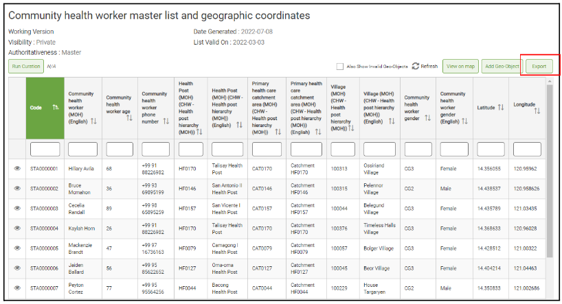
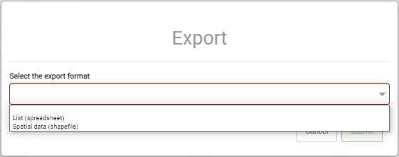
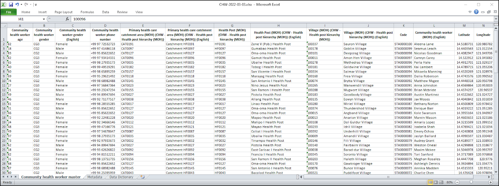
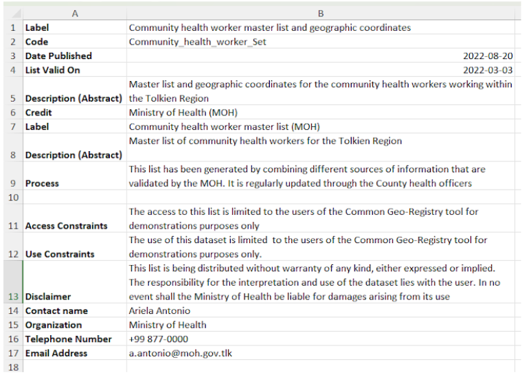
Export Lists
Lists are exported to spreadsheet with associated metadata.
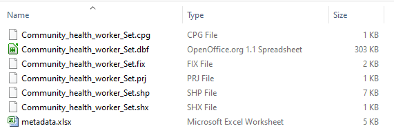
Export Geospatial Data
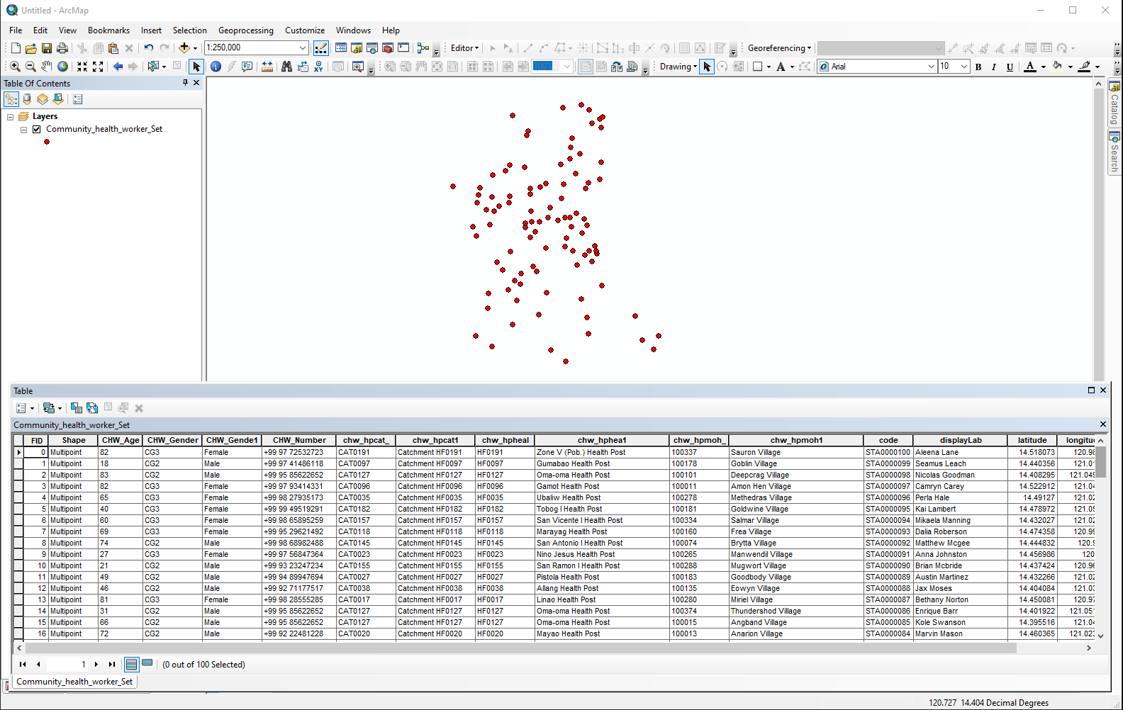
Geospatial data is exported to shapefile with associated metadata that can be viewed in other mapping software like Quantum GIS.
Historical Events
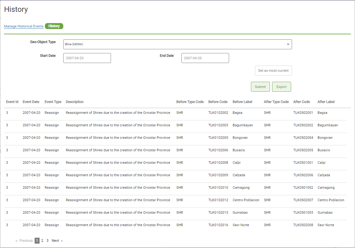
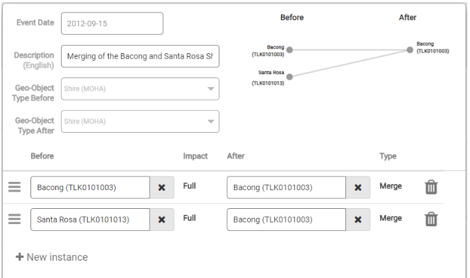
GeoPrism Registry allows for capturiong the changes to Geo-Objects such as when there are splits, merges, reassignment, upgrades (moving up the hierarchy), or downgrades (moving down the hierarchy).
Create A Historical Event
A graphical interface allows for configuration of a historical event.
View A History Of Historical Events
Historical events are listed with the ability to focus on events for specific Geo-Object Types.
